The Sights of Arran - part 2
Welcome back to a little glimpse into the sights and scenes of Arran. In my last blog I gave an introduction and covered the wildlife images that I captured whilst there. This time I will focus on the Landscape images that I took from this great Island.

I want to start with those of Goatfell and the Glen Rosa Valley. Goatfell is the highest peak on the island at 874m, and is the last in a circular chain of peaks that encompass the top end of a 4-5 mile valley called the Glen Rosa Valley.
The great characteristic of this peak is that it towers over the coastline almost throwing down a challenge every time you look at it. The image to the left was taken from a road just 100m from the shoreline and the whole hike from there was only 2 hours to the top on a relatively easy trail.


(Images taken on iPhone 15 - no edits)
It’s a fantastic walk which rises quickly through forested areas into the managed forestry areas where there are large areas that have been cleared and leave a landscape of stumps and shrubbery (Left image). Here you can also see the effects of the wildfires that ravaged the island just before we came.
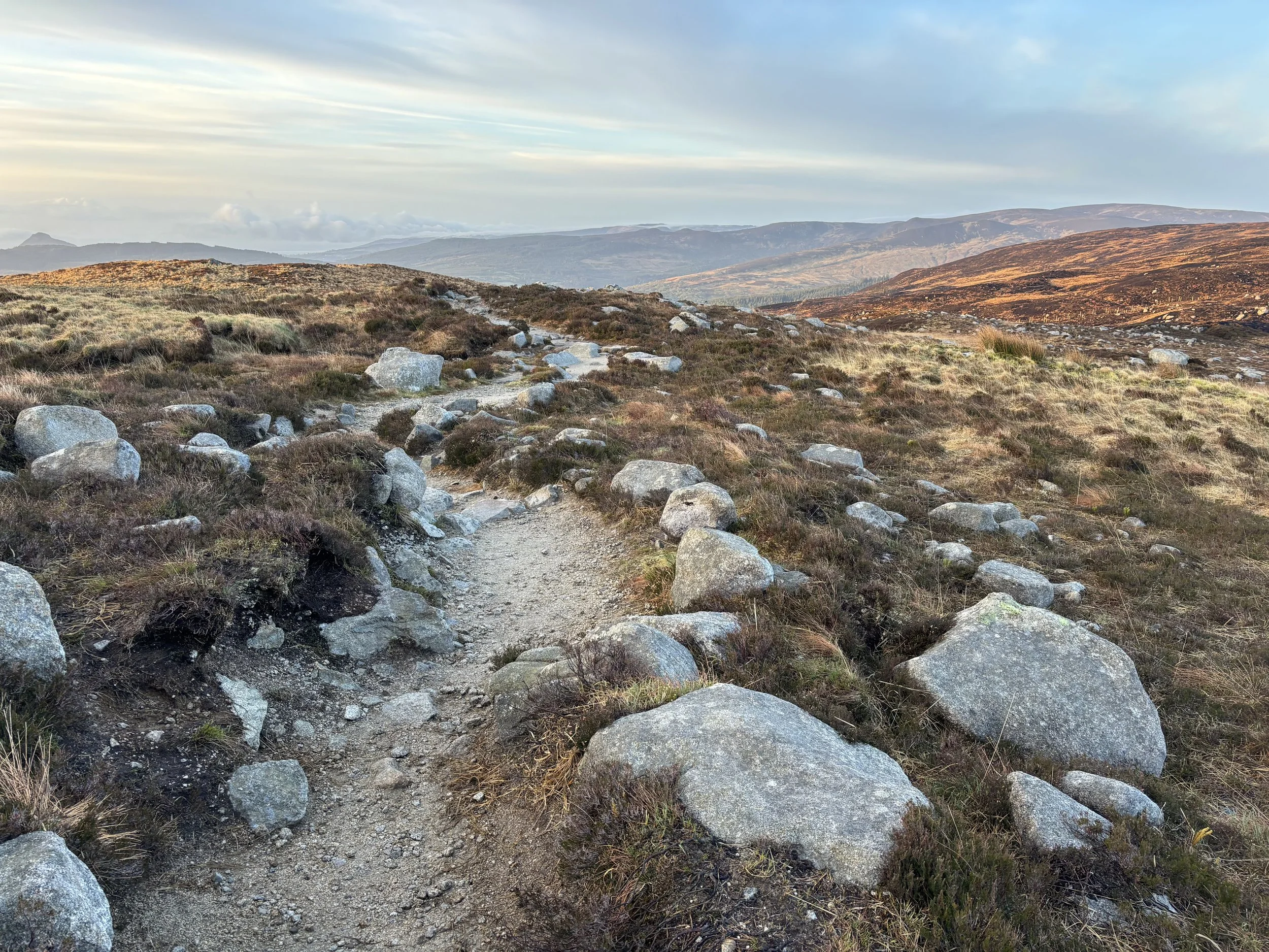
As you progress upwards you leave the treeline, pass over a stream and gate into the rocky wildness of the lower slopes where the terrain becomes more rugged and rocky (Middle image looking back and right looking up towards the peak)
From here its a simple trail to follow but with a very steep and fairly technical last 40 minutes after which you are rewarded with some amazing views


The above images show the view from the summit looking back along the Ridgeline and other peaks at the top of the Glen Rosa Valley.
The right shows a view from the summit back down towards the town of Brodick, then further back to the next bay along which is where the village of Whiting is (and the Drift Inn which has beautiful food!) . The island that’s poking up just in front of the clouds is called Holy Island and was given to the Samyé Ling Buddhist Community in 1992.

This is a view from my DJI mini 2 Drone looking back over the range. For a 360 degree view you can have a look at a short video on my YouTube here:
https://youtu.be/c1rUZIU-RfY
From here I decided to walk along the Ridgeline towards the top of the valley - it’s a tricky route with steep drops either side. As I was making my way across the effects of the wild fire became clear to see, with a whole side of the valley consumed and backed with ash.
You’ll be able to see in the images below how the fire reached almost to the top of the ridge and it almost looked like blackened fingers were reaching for the skies.
As I descended into the valley for my return trip the impacts were even more visible, and went on for a good couple of miles as I waled back home in the late morning sun


That was it for the strenuous part of the holiday - the rest was a much more relaxing affair with wanderings around various places.
There were a couple of overcast days and the coastline presented some wonderful opportunities for images - a selection are shown below with descriptions of where they were taken and why:


Finally I was experimenting with some letter box edits, something I have been trying out a little more recently


